SEARCH SITE BY TYPING (ESC TO CLOSE)

Blog

NASRDA signs agreement with GS Group, eGate Technology to digitalise traffic management

Halilu Ahmad Shaba, the director-general, National Space Research and Development Agency (NASRDA), has described the Radio Frequency Identification (RFID) technology as a tool for advancing the socio-economic development of the country.

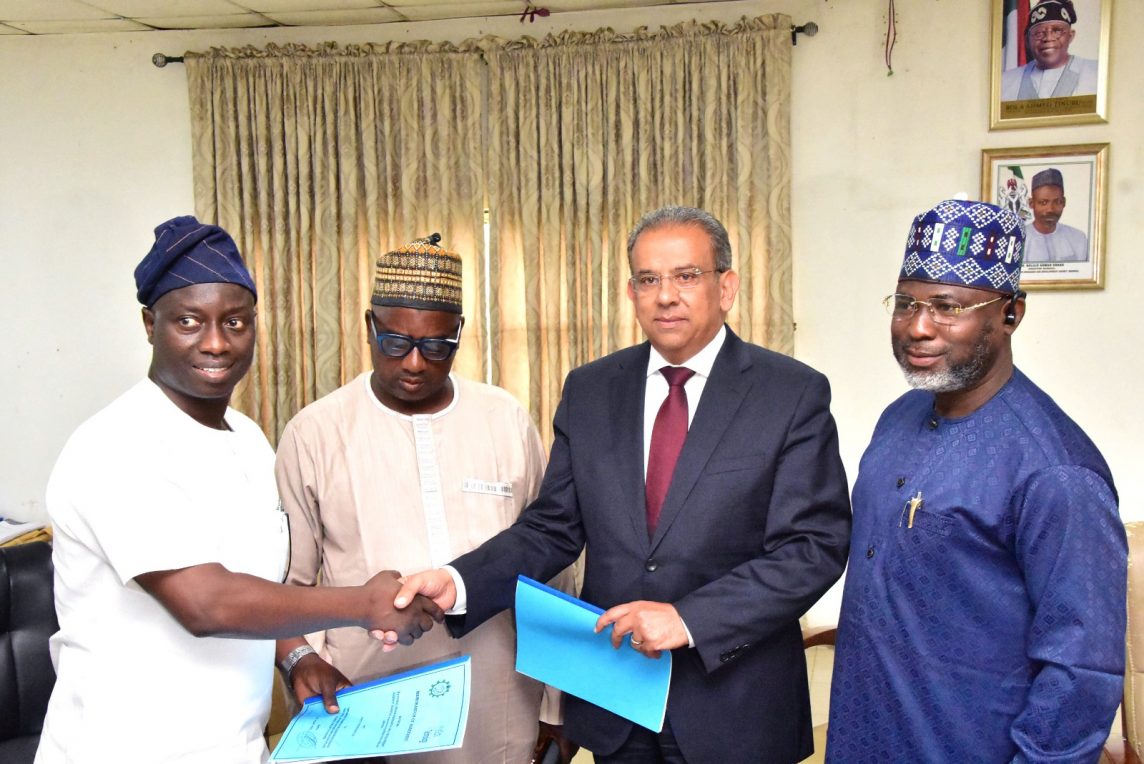
Shaba who was represented by Halidu Ibrahim, director, ground station and mission control, made this statement during the signing of a tripartite agreement between NASRDA, e-GATE Technology Limited and GS Technology on investment, establishment and implementation of smart traffic management, telemedicine, and other digital services for the country at the agency’s Headquarters in Abuja.

According to him, the speedy implementation of the agreement will further boost the economic drive of the country by creating a platform for effective monitoring and management of activities that are considered as critical to the economic growth of the country.

The NASRDA boss expressed satisfaction with the contributions of the parties involved and encouraged them not to relent, but to map out strategies that will allow for the effective implementation of the agreement so that Nigerians can begin to enjoy its benefits.

He explained that the space agency will do everything within its power to ensure that it contributes its quota to the development of space science and technology in the country through result-oriented collaborations with government agencies and relevant stakeholders in the interest of nation-building.

Gaseer Elsayed said: “Today we are honoured to be selected to implement our state-of-the-art RFID technology and intelligent traffic management system with country footprint infrastructure that poses many critical challenges in most modern cities, including congestion, traffic violations, car theft, and illegal vehicles. system systematically collects information to be used in dynamic traffic guidance to solve traffic congestion. Additionally, identify a car’s basic data which is the first step for digital transformation in the traffic sector.”

Essam Elsaghir said: “We are grateful and honoured to be selected. by NASRDA with our strategic partner “GS group” one of the leading companies in Smart Road & RFID technology in the region to implement this innovative traffic management system and create a unified central database using unique RFID tag that will be attached to vehicles and send signals to central computer system, which will use it to optimise traffic control, safety and flow.

“RFID technology is a powerful tool that will be used to improve traffic flow and reduce congestion. We are confident that this system will make a significant difference in the way people travel, expected to reduce congestion by up to 20%. It is also expected to improve air quality and reduce noise pollution.”

On his part, the acting managing director of GeoApps Plus Limited, Emmanuel Onwubuariri, who expressed delight at the pace of the collaboration that led to the signing of an agreement, commended the efforts of the director-general and the collaborating team, describing the epoch-making event as a giant stride that will change the fortune of the country.

Onwubuariri said the project is not only aimed at providing solutions to challenges in critical sectors of the economy but to also generate income for the nation, especially at a period where government policies are geared towards the diversification of the economy.

He, therefore, encouraged government agencies and relevant stakeholders to spread their tentacles wide enough to exploit areas and avenues that can boost the Nigerian economy in line with international best practices.

The RFID is a wireless device with antennas that emit radio waves and receive signals back from the RFID tag.

Its benefits include the improvement of tracking, product handling efficiency, inventory counting speed as well as automating product receipts, storage and distribution.

Mahmoud Fathy said: “GS Group and its companies which are specialised in the field of information technology and traffic management systems have their experience and previous work on automation and developing the RFID tags system and vehicles technical inspection and driving learning in Arab Republic of Egypt, United Arab of Emirates, and other African countries in accordance with the latest modern scientific and technological methods.

“GS Group newly established a local Nigerian company, GS Technology Nigeria, to be the local representative of GS Group in all potential traffic management projects that could be implemented in the Federal Republic of Nigeria.”

Source: The Cable
READ MORE

FG to establish N3.5bn space museum, planetarium

A planetarium is a specially-designed theater with a domed ceiling that is able to project a realistic image of the night sky indoors

READ MORE

GITEX TECHNOLOGY WEEK 2021

Date:  17-21 October
Place: Dubai World Trade Center, Dubai

GITEX Technology Week is one of the largest trading events in Dubai, and it is back again this year. It is a gateway for global brands to access the Middle East, one of the fastest emerging investment-ready ICT markets. 

Atlantic Factorial Ltd is participating this year.

We are looking forward to meeting you all!

More about products on stand: https://gitex.speechpro.com

READ MORE

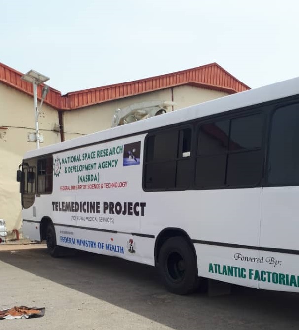
Nigerian Space Agency launches telemedicine facility to support Covid-19 testing in Nigeria

In order to mitigate the spread of coronavirus pandemic in the country, the Federal Ministry of Science and Technology through its agency, the Nigerian National Space Research and Development Agency (NASRDA) has collaborated with the Federal Ministry of Health and Atlantic Factorial Ltd for the use of telemedicine facility for mobile testing of the virus.

Telemedicine was one of the target applications of the Nigerian Communications Satellite which carries Hughes VSAT equipment, Polycom video equipment and AMD telemedicine
(NOC). The pilot project was designed in collaboration with the Ministry of Health, while the sub-networks integration commenced in March 2007 with the Network Operation Centre. The initial plan was for the integration of the sub-network to include Eight Remote Terminals and One Mobile Unit commissioned in January 2008.

The remote terminals are in Bayelsa, Bernin Kebbi, Ibadan, Gombe, Maiduguri, Makurdi, Owerri, and Owo, spread across the geopolitical zones in the country. The remote terminals and mobile bus are equipped with basic diagnosis equipment such as Cameras (General Examination Camera, Image & Illumination System) and Diagnostic Scopes (Electronic Stethoscope –Ear, Nose & Throat (ENT) Scope, Ophthalmoscope and Dermascope).

While speaking in Abuja, the Minister announced the Ministry of Science and Technology will make use of this facility to support the work of the Ministry of Health in curbing COVID-19 across the country. According to the Nigeria Centre for Disease Control (NCDC), as at 09:00 pm on 8th April, there are 276 confirmed cases in Nigeria, 44 have been discharged and 6 deaths have been recorded.

The Managing Director of Atlantic Factorial Limited, the lead partner of NASRDA on the project, Mr Olugbenga Leke Oyewole who commended the Acting Director General of the space agency and his management team emphasesed the need for public private partnership in the space sector in NIgeria particularly at this point in time.
This according to him will provide for the attainment of maximum efficiency and affordability for the growth and development of the sector which he described as critical to various development programmes and efforts anywhere in the world.

Mr Oyewole described the Telemedicine project as a great achievement for the space agency and the present administration under President Muhammadu Buhari, saying government at levels should take advantage of this modern technology to revolutionise the health sector in the country.

Source: Space in Africa

READ MORE

WHAT ARE THE IMPORTANT THINGS YOU NEED TO KNOW ABOUT NDVI?

NDVI remain one of the most commonly used vegetation indices in remote sensing since the 70s. With the increased availability of remotely sensed imagery from satellites and UAVs, more and more people have come to adopt NDVI in their activity beyond the scope of science.

Agriculture is now the most popular industry leveraging such advantages of satellite data as large area coverage, accuracy of results, and high acquisition frequency, which means that territory as small as a single field or as huge as an entire country can be observed from space at a certain frequency.

And yet, there’s still a lack of knowledge and lots of misbeliefs around these mysterious vegetation indices. To help users better understand how to work with NDVI in the most effective way and reap most benefits, we prepared useful answers to likely questions from our customers.

1. What is a VI, or vegetation index?

You should know that vegetation’s spectral reflectance across different bands measured by the sensor serves as an indicator of the presence of plants or trees and their overall state. So, VI is a mathematical combination of two or more such spectral bands that enhances the contrast between vegetation (having high reflectance) and bare soil, manmade structures, etc. as well as quantifies plant’s characteristics, such as biomass, vigor, density, etc.
There are over a hundred indices for vegetation analysis; to learn more, check the Index Database.

2. What is NDVI in remote sensing?

The Normalized Difference Vegetation Index is a simple indicator of photosynthetically active biomass or, in layman’s terms, a calculation of vegetation health.

3. What does NDVI show?

Simply put, NDVI helps to differentiate vegetation from other types of land cover (artificial) and determine its overall state. It also allows to define and visualize vegetated areas on the map as well as detect abnormal changes in the growth process.

4. How to calculate NDVI?

NDVI is calculated with the following expression: NDVI = (NIR-Red) / (NIR+Red), where NIR is near-infrared light and Red is visible red light. There are various free online GIS tools that allow you to instantly calculate NDVI.

5. If you need to calculate NDVI, which type of bands you would use?

As it follows from the NDVI formula, you need to take reflectance value in two bands: the visible red band and near-infrared band. Please note that you won’t be able to calculate NDVI by using natural color imagery or another type of band composites, even though they may contain the required bands.

6. How does NDVI work?

Basically, it works by mathematically comparing the amount of absorbed visible red light and the reflected near-infrared light. And here’s why.

The chlorophyll pigment in a healthy plant absorbs most of the visible red light, while the cell structure of a plant reflects most of the near-infrared light. It means that high photosynthetic activity, commonly associated with dense vegetation, will have fewer reflectance in the red band and higher reflectance in the near-infrared one. By looking at how these values compare to each other, you can reliably detect and analyze vegetation cover separately from other types of natural land cover.

7. What NDVI value represents healthy vegetation, a positive one or a negative one?

As you may know, the results of the NDVI calculation range from -1 to 1. Negative values correspond to areas with water surfaces, manmade structures, rocks, clouds, snow; bare soil usually falls within 0.1- 0.2 range; and plants will always have positive values between 0.2 and 1. Healthy, dense vegetation canopy should be above 0.5, and sparse vegetation will most likely fall within 0.2 to 0.5. However, it’s only a rule of thumb and you should always take into account the season, type of plant and regional peculiarities to know exactly what NDVI values mean.

8. How to measure density of vegetation with NDVI?

In most cases, NDVI values between 0.2 and 0.4 correspond to areas with sparse vegetation; moderate vegetation tends to vary between 0.4 and 0.6; anything above 0.6 indicates the highest possible density of green leaves.

If you’re analyzing crops with NVDI, make sure to take into account the type of planted crops and the row width as you interpret the obtained results.

The problem with NDVI as a tool to measure vegetation density is that it saturates at high amounts of green biomass. Simply put, you may end up having the same NDVI readings for low and very high vegetation density. Consider using EVI (Enhanced Vegetation Index), which is an adjusted version of NDVI that is especially accurate in areas with a dense canopy. Another alternative is NDRE (Normalized Difference Red Edge), an index that is good for permanent thick crops or other dense crops.

9. How to interpret NDVI images?

Traditionally, NDVI results are presented as a color map, where each color corresponds to a certain range of values. There’s no standard color palette, but most software uses the “red-green” one, meaning that red-orange-yellow tints indicate bare soil or dead/sparse vegetation, and all shades of green are a sign of normal to dense vegetation cover.

If you still don’t know how to read NDVI imagery, just check the index legend, like the one we have in LandViewer (as shown on the image in the bottom right corner). And remember that some software lets create your own index palette.

10. What are the alternatives of NDVI?

Actually, there is a fair amount of vegetation indices, which are based on the standard NDVI. Unlike it, they are adjusted for soil brightness, atmospheric effects, and other factors usually affecting NDVI results. They are EVI, SAVI, ARVI, GCL, SIPI.

11. What does an NDVI measure in crops?

Simply put, NDVI measures the state and health of crops or crop vigor. This vegetation index is an indicator of greenness and has a strong correlation with green biomass, which is indicative of growth. NDVI values are also known to have a high correlation with crop yield, meaning it can be used as a tool for measuring crop productivity and predicting future yield.

12. Can NDVI show the phase of crops?

As a matter of fact, NDVI values obtained with satellite data with high temporal resolution (e.g., MODIS) have a strong correlation with crop phenological stages (emerged, maturity, harvest). However, there are certain limitations. For instance, during the early stages of crop growth, when the green leaf area is small, NDVI results are very sensitive to soil background effects. The NDVI may also saturate at later stages, when the crops reach canopy closure, and produce inaccurate results.

13. Is NDVI value different for different cultures?

It certainly is. Every crop type has a different canopy structure, growth stages, and requires specific climatic conditions for growing properly. All these factors influence crop’s reflectance properties and, as a result, produce different NDVI values across various crop types.

14. What is a normal value NDVI for corn/wheat/rapeseed/soybean?

Unfortunately, there are no established norms of NDVI values for different crop types because every field is unique and readings depend on a combination of various factors (climate, soil type, agricultural management practices). We recommend taking satellite data across several seasons and generating NDVI Time Series to identify the growing patterns and normal values for your own field.

15. Can I use NDVI for vineyards?

It depends. NDVI has been used to assess the vine vigor, but the accuracy will depend on soil management practices. If there’s cover crop growing between vine rows, it will be hard to distinguish areas corresponding to vine NDVI from those corresponding to cover crop NDVI. If inter-rows only have bare soil in them, NDVI results tend to be more accurate.

16. How to use NDVI in agriculture?

When it comes to crops, there’s a bunch of applications. NDVI can be used to:

1) Measure biomass and assess the state and health of crops
2) Identify pests just like the recent locust infestation in East Africa: (Somalia, Ethiopia, Kenya), diseases, fungus, or overly dried spots in the field before the damage is done
3) Observe vegetation dynamics throughout the growing season
4) Establish normal growing conditions for the crops in the specific area with NDVI Time Series
5) Estimate crop yields (never alone, only combined with other parameters used for prediction)
6) Detect areas of concern within the field faster, and spend water, crop nutrients, and pesticides more effectively
7) Monitor pasture conditions and productivity
8) Monitor drought and assist in forecasting fire-hazardous areas

17. Can NDVI be used to optimize fungicide application?

Definitely, yes. First, you can use NDVI maps of your field to validate the results of applying various fungicides and see which one leads to healthier and more resistant crops. Second, the NDVI image can be used as a prescription map showing you the areas, where crops may have been suffering from fungal disease, so fungicide can be applied accordingly. It will cost you less than spraying the entire field.

18. How can NDVI assist in eradicating weed infestation?

The NDVI profile of weed-free crops differs noticeably from that of the weed-infested crops.

According to multiple studies, NDVI images can be used for detecting late-season weed infestations in crops. Calculated from aerial or high-resolution satellite images acquired a few weeks before crop senescence, NDVI can help you differentiate between weed-free and weed-infested plants, the latter would be having a higher spectral response (= higher NDVI values). Alternatively, weed areas can be detected with post-harvesting images. NDVI images can, therefore, serve as herbicide prescription maps letting you spray only the weed patches instead of the whole field and reducing the environmental impact and costs.

19. Is NDVI an effective risk management tool for crop insurance?

It surely is. Insurance companies have been reaping the benefits of using satellite technology and NDVI images, in particular, to:
– quickly and accurately quantify losses caused by severe weather, overspray, drought, etc. spending far less time and human resources;
– get field insights with historical imagery dating 30-40 years back;
– monitor fields of any scale (from a district to a region/state or a whole country), with real-time updates and get ready for indemnity payments early on;
– identify fields that are not eligible for payment (e.g. illegal burning).

20. How to differentiate between crops and trees?

We agree this can be tricky. Both crops and trees can have high NDVI values, which makes it challenging to distinguish between the two. The easiest way is to calculate the mean NDVI value for each of the 3 months in the past year. The vegetated areas having high NDVI values for more than 3 months in a row will most likely mean coniferous forest. Crops rarely maintain high NDVI this long.

21. How to detect forest clearing/deforestation with NDVI?

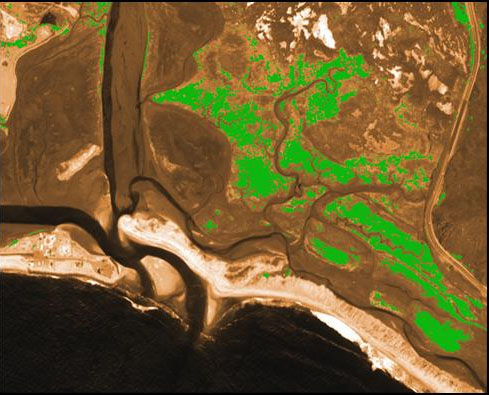
Well, you’ve got options here. You can calculate the mean NDVI value for several months since the date of alleged forest clearing and compare it with the mean NDVI of the same months a year ago. If there’s at least a 0.25 drop in NDVI, then you’ve most likely spotted a tree cut. Or you can use an automatic change detection tool: it will highlight the spots, where any land cover changes have taken place, on a pair of images taken at different dates (preferably, for the same month across different years).

Massive cutting of old-growth forests on Vancouver Island, Canada between 2017 and 2018

It’s important to perform analyses with imagery having the lowest possible cloud cover to avoid false negative values. The problem with this method is that it doesn’t identify the exact reason of forest loss. Aside from clearing, the forest cover loss can be due to wildfires, hurricanes, or use of chemicals.

22. Is it possible to measure forest temperature and identify forest fires with NDVI?

Not really. NDVI formula doesn’t have the bands to do this. However, NDVI has gained the reputation of drought detector, which means it can point out the areas covered with overly dry vegetation (= low NDVI values), where fire risk is obviously at its highest. And as an added feature of Atlantic Factorial Agriculture solutions that is not a problem: https://atlanticfactorial.com/agriculture/

23. Сan NDVI be used to measure forage abundance?

Actually, the answer is yes and no. Cattle farmers are known to have used NDVI to check on the presence and conditions of grass on their pastures. However, if you’re dealing with areas where forage grasses are hidden under a dense tree and/or bush canopy (e.g. tropical forests), NDVI will not be reliable as a grass abundance measurement tool.

At Atlantic Factorial Ltd, we are committed to looking for these answers, and to harnessing the amazing progress of this technology to build accurate and competitive information products that can provide answers to our customers’ questions everyday and anywhere. Stay tuned for updates!

READ MORE

Malpractices in meteorology, maritime sector undermining economy, security — NASRDA

NPA, NIMET collaborate, sign MoU

By Godwin Oritse

WITH growing security concerns across Nigeria, some maritime experts have revealed the malpractices and neglect that are currently undermining government revenue and security services in the maritime sector.

Against this backdrop and fuel by the incessant and violent damages done to vessels as a result of frequent sea swells (violent waves), the inability of the country to have accurate weather forecast, the Nigerian Ports Authority, NPA, is collaborating with the Nigeria Meteorological Agency, NIMET, to provide accurate weather forecasts for safe navigation.

Confirming the collaboration, Captain Ihenacho Ebubeogu, a former general manager, marine and operations at the NPA, now in charge of security said the partnership started in 2017.

Ebubeogu, however, said he could not give an update on the collaboration but referred Vanguard Maritime Report to the Marine department of the NPA.

A source close to the office of the Managing Director of the NPA, Ms Hadiza Bala Usman, said that a Memorandum of Understanding, MoU, has been signed by both agencies, adding that the MoU, was already work in progress.

Vanguard Maritime Report also gathered that the collaboration between NPA and NIMET will see to the establishment of some coastal meteorological stations across the country.

It was also gathered that both agencies have been meeting towards enhancing Nigeria’s weather forecasts to users of meteorological information.

Accurate weather forecast

Recently due to inaccurate meteorological data, some vessels such as the M. T Nwobisa was washed ashore in the Niger Delta region.

Speaking on the development, Engr. Akin Olaniyan, managing director of International Naval Survey Bureau, INSB, a vessel classification and survey firm in Lagos, said that Nigeria ought to have mastered the art of accurate weather forecast has been a maritime nation for more than 70 years.

According to him, the sourcing of meteorological data from abroad is a failure of the nation’s maritime authorities.

He said: “By now, we should have mastered the sea more than we are doing. Our safety departments should have taken advantage of emerging technologies to predict weather conditions so as to warn all vessels within her territories and particularly Nigerian flagged vessels.

“Meteorological services can be deployed via water buoys to predict weather conditions. This is not rocket science. It is the duty of the flag administration to protect her vessels from such natural disasters or at the least warn of an impending situation. This is the hallmark of a developed administration and not its representation at the IMO.”

However, speaking on the development, Dr. Felix Ale, spokesman of the National Airspace Research Development Agency, NASRDA, told Vanguard Maritime Report that the agency has the capability to provide accurate weather forecast for use by any agency in Nigeria.

Ale said that weather reports are sent to relevant government agencies as frequently as possible adding that there was no need for officials of government to go abroad for this purpose.

He alleged that some officials of government who claimed the inability of Nigeria to give accurate meteorological data frequently travelled abroad with fat estacodes.

According to him, most times, officials of government engage foreign companies to source meteorological information for Nigeria and these foreign firms get these information from NASRDA and sell to these officials of government.

Ale stated: “Officials of government agencies go abroad to engage foreign companies to source meteorological reports on Nigeria. These foreign firms, in turn, come to NASRDA to source this information and sell to these officials. Some of these officials do this because of the estacodes they get when they travel abroad. They should stop this idea of running abroad for satellite data information when these data are available in Nigeria.”

Already, NARSDA has entered into a joint venture agreement with Atlantic Factorial to provide a high-resolution image of activities on the waters.

Massive leakages

Confirming the joint venture agreement, managing director of Atlantic Factorial, Mr. Leke Oyewole, said that massive leakages have been observed in the maritime sector occasioned by inadequate surveillance of the maritime domain, adding that NPA and the Nigerian Maritime Administration and Safety Agency, NIMASA, were not being paid revenues due to them because of these trade infractions.

Oyewole said that most of the International Oil Companies, IOCs, sourced meteorological data from abroad and deducted the cost of sourcing this information from their operating costs before declaring profit to the Federal Government.

He said: “We currently boast of the largest constellation of satellites (240 +), belonging to our partners and over 100 ground stations globally. Our capability cuts across sub-meter resolution imagery of any location on the planet (72cm, not surpassed by any other company worldwide), maritime, aviation, meteorology and radio frequency analytics.

“In recent years, the need to monitor our highways, bushes, remote communities, towns and cities has come to the fore. We can provide for the government, daily surveillance reports detailed by radio frequency communications and high-resolution imagery with short videos of suspected locations within the entire expanse of Nigeria for security action.

“Similarly, we have observed massive leakages in the maritime sector occasioned by inadequate surveillance of the maritime domain. Mother ships that import petroleum products to Nigeria with official foreign exchange, either import through neighbouring countries or when they come to Nigeria, NPA/NIMASA are not paid revenues due to them because these ships don’t get to the ports by reason of their size.

“We have unreported exports of petroleum products by ship-to-ship transfer offshore, products that never got to the ports are taken directly to bunker rigs offshore, quantity under-declarations, crude oil theft, and so on, are some of the anomalies in the coast. Our technology can track all ships globally per second/24 hours. Superior to the existing technology in Nigeria is the fact that we also unveil dark ships and we can point all ships evading payments to NPA, NIMASA, NNPC and the Customs.

“Automation and integration procedures and processes of all maritime agencies on a platform will enable Nigerians to clear their cargo from homes and offices without going to the ports. This will minimize corruption and decongest the ports. In the aviation sector, we not only provide complete and total coverage of Nigeria with all aviation weather requirements, but we also track all aircraft for the number of hours in the air since the last maintenance to keep track of next due maintenance and for NAMA to act.

“Our meteorological services will surely reduce operational costs of NIMET by 50 per cent and increase its Internally Generated Revenue, IGR by 200 per cent. We cover maritime meteorology, aviation from 70km vertically (adjudged to be the best globally) and provide agricultural services at global best. We provide a seven-day advance forecast to allow enough time to prepare for severe weather conditions.”

Oyewole added that the partnership his organisation enjoyed with HawkEye 360 (presently the only commercial company worldwide in the business of satellite radio frequency analytics) affords it the ability to detect and independently geo-locate sources of radiofrequency with an accuracy of less than one-kilometre world over.

He also said that the apparent lack of capacity by NIMET, which is the official meteorological agency, and the inability of NIMASA to outsource the service was costing the country colossal losses in the shipping sector.

Efforts to get comments from the NIMET was futile as calls and text messages to the phone of Engr. Tokunbo Okulaja, an official of the agency were not answered.

Commenting on the development, the former hydrographer of the NPA, Mr Gbenga Omotosho, said that meteorology and hydrography cannot work without each other adding that vessels need both hydrographical and meteorological information for safe navigation.

Omotosho explained that hydrographers also train as meteorologists, noting: “The strength of water is greater than the one on the land, the vessels need this information for safe navigation.”

Source: Vanguard

READ MORE

NASRDA signs MoU with Atlantic Factorial, others

In a bid to appropriately fulfil its core mandate and the main thrust of its establishment, the National Space Research and Development Agency, (NASRDA) on Wednesday, February 27th, 2019 in Abuja signed a Memorandum of Understanding (MoU) with three organizations aimed at making space science and technology applications an integral part of the overall strategies for sustainable national development.

The three organizations are:
Atlantic Factorial Limited, Kaduna State University, and University of Ilorin.

Speaking at the event, the Director General of NASRDA, Prof. Seidu O. Mohammed reiterated the Agency’s readiness to partner with other allied organizations towards making space and Science and Technology spinoffs available to the ordinary man on the street.

The DG, who stressed the need for functional MoUs between the Agency and its partners, also maintained that the Agency’s door remains open for those that are interested in the diversification of our national economy through scientific and technological applications.

The three organizations who spoke through their respective representative commended the leadership style of the Director General and the Agency’s leadership for their vision oriented commitments to advancing Space science and Technological activities in Nigeria, saying that, tertiary institutions in the country have benefited a lot in research through satellite imageries obtained from the nation’s orbiting satellites.

On his part, the Director of Strategic Space Application, Dr. Shaba, who gave the vote of thanks at the event, called on the Agency’s partners to go beyond the euphoria of signing MoU and be committed to working their own part of the partnership, adding that, the Agency has been giving out satellite data to tertiary institutions in the country that worth over 120m Naira annually at no cost.

Originally by Space in Africa

READ MORE